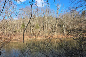
This is a beauty of a little hike down a paved path to the Point Bonita Lighthouse. The trail is not steep, but is more or less continuously sloped down. The day I went, the end of the path was closed, so I couldn’t get all the way to the lighthouse. The trail is worth an exploration even so, with great views of the Golden Gate, San Francisco, the Marin Headlands, and the Pacific Ocean. The day I went, the pelicans were out in force, and there’s clearly a huge colony living on a rock just outside the gate.
Description:
The trail starts on the south side of the point, directly in line with the few parking spaces at the end of the road. It’s paved and sloped down, with enough guard rails for even me to feel perfectly comfortable in spite of the steep cliffs.
I snuck this hike in on a day between two storms, which meant epic clouds and great surf – but a little water on the camera lens.
The Point Bonita Lighthouse trail was a treat, and quite short – less than a mile because the end was closed. When I got back to the Parking Lot, I decided to do some unscripted exploring, and also had a lovely little walk to the Bird Island Overlook, which extended the hike by about 0.5 miles.
Interesting bits:
Plant IDs:
Artemisia californica – California Sagebrush
Plantago coronopus – Buck’s-horn Plantain
Oxalis pes-caprae – Bermuda Buttercup
Cupressus sp. – Cypress
Activities and Amenities:
There are bathrooms at the parking lot and a few hikes that start here. The trail itself has several vistas with benches, but no picnic tables or areas with wide open spaces for an extended break. This is really all about the out and back. I didn’t have cell service.
Getting there:
You’ll want to follow a map or GPS program if you’re not familiar with the area, it’s a bit twisty turny to get there, and from the direction I was traveling, it was one exit before the bridge. I hate it when I go to San Francisco by accident. (It happens.. fortunately, not a lot.) If there’s no parking at the end of the road parking lot, there’s a larger one just slightly down the hill. Also, download your maps because cell service is minimal.
Links:
- You tube
- All trails
- iNaturalist
- The Park – Golden Gate National Recreation Area
- Google maps to the parking lot